What Makes London Work Like London?
- Sawsan AlHalawani1
- Yong-Liang Yang1
- Peter Wonka1
- Niloy J. Mitra2,1
1KAUST, 2University College London
12th Symposium on Geometry Processing (2014)
Abstract
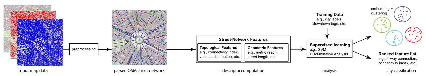
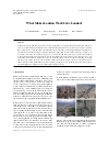
Urban data ranging from images and laser scans to traffic flows are regularly analyzed and modeled leading to better scene understanding. Commonly used computational approaches focus on geometric descriptors, both for images and for laser scans. In contrast, in urban planning, a large body of work has qualitatively evaluated street networks to understand their effects on the functionality of cities, both for pedestrians and for cars. In this work, we analyze street networks, both their topology (i.e., connectivity) and their geometry (i.e., layout), in an attempt to understand which factors play dominant roles in determining the characteristic of cities. We propose a set of street network descriptors to capture the essence of city layouts and use them, in a supervised setting, to classify and categorize various cities across the world. We evaluate our method on a range of cities, of various styles, and demonstrate that while standard image-level descriptors perform poorly, the proposed network-level descriptors can distinguish between different cities reliably and with high accuracy.
Results
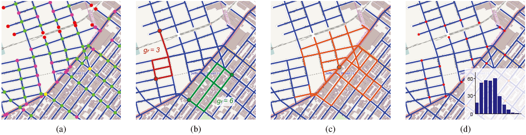 Figure 2: Topological and geometric features for the same layout: (a) Valence, red (val = 1), purple (val = 3), green (val = 4), and yellow (val > 4); (b) Redundancy for two pairs of nodes; (c) Metric reach with 0.5 km; and (d) Travel distance histogram for the 25 sampled nodes.
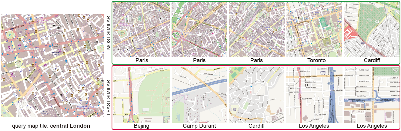 Figure 3: Finding ‘sister’ cities. Based on a query layout from central London, we show a sampling of very similar and dissimilar examples from other cities. Please refer to text for more details.
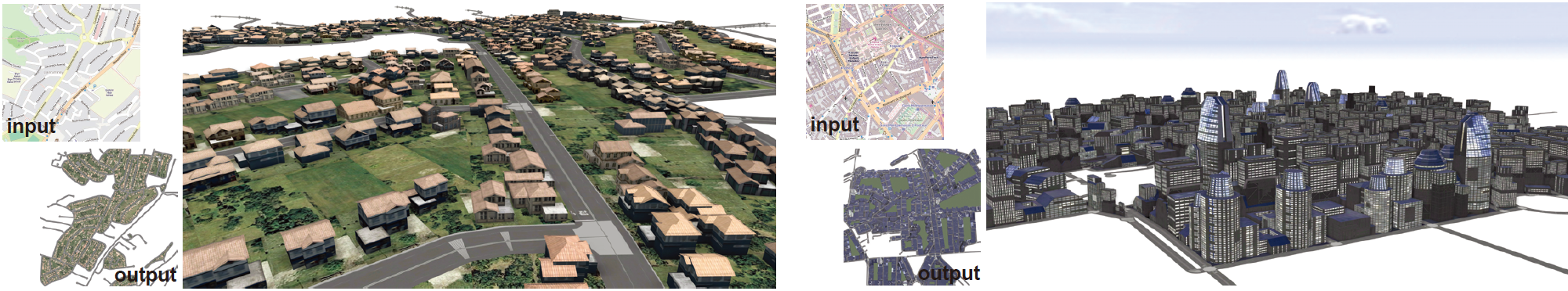 Figure 4: Starting from random city tiles, we procedurally make the respective tiles more London-like by lowering feature distance (using features proposed in this work) to those of the targets. Inset shows the target London tiles (outskirts and downtown, respectively).
Acknowledgements
We thank the reviewers for their comments and suggestions for improving the paper; Jun Wang for creating renderings in CityEngine; Han Liu for proofreading the paper. This work was supported in part by the Marie Curie Career Integration Grant 303541, the ERC Starting Grant SmartGeometry (SG-20t13-335373), an Anita Borg Goggle PhD scholarship award, and gifts from Adobe Research.
BibTex
@ARTICLE{AYWN2014,
title = {What Makes London Work Like London},
author = {Sawsan AlHalawani and Yong-Liang Yang and Peter Wonka and Niloy J. Mitra},
journal = {Computer Graphics Forum (Proceedings of SGP 2014)},
volume = {33},
issue = {5},
year = {2014}
}
Paper (10MB)
Paper (4.5MB)
Slides (3.7MB)

Code / Data (1.25 GB)